South Pas CERT Events for 2019

Our friends at the South Pasadena Community Emergency Response Team have released their calendar of events for the rest of 2019. We’ve added these events to our calendar page and will update the listings if/when new dates are announced. Visit the CERT page to register for the refresher course or the fall training session.

May 25, 2019
8am – noon
CERT Refresher Training (held at SPFD)

July 4, 2019
9am – 2pm
CERT Booth in Garfield Park after the annual Festival of Balloons

August 6, 2019
6 -9pm
CERT Booth at National Night Out in Orange Grove Park

September 21, 2019
8am – 1pm
Basic CERT Training, fall session week 1 (held at SPFD)

September 28, 2019
8am – 1pm
Basic CERT Training, fall session week 2 (held at SPFD)

October 5, 2019
8am – 1pm
Basic CERT Training, fall session week 3 (held at SPFD)
A Podcast and an App to Help You Prep for a Quake

Local NPR station KPCC commemorated the twenty-fifth anniversary of the devastating Northridge earthquake with coverage on-air and on its news site LAist. They’ve also produced a new podcast to help you get ready for the next quake, one that could be even more damaging than Northridge. It’s called The Big One: Your Survival Guide, and it’s available wherever you download podcasts. The podcast’s homepage includes links to KPCC/LAist articles on earthquake prep and an interactive map to visualize faults and liquefaction zones in our area. (You may not like what you find!)

Separately, the City of Los Angeles has released an app called ShakeAlertLA. It is designed to give you an advanced warning of a quake if one is detected by the ShakeAlert system. Dr. John Vidale of the Southern California Earthquake Center gave a talk on ShakeAlert at a SPARC-sponsored community meeting last May.

More information and a video about the app can be found in this LA Times article by Ron-Gong Lin.

Photo taken Saturday, January 22, 1994 by Gary B. Edstrom, and released to the public domain via Wikimedia Commons.

How to Take an Online FEMA Class

The Federal Emergency Management Agency (FEMA) offers self-paced independent study courses for those who have emergency management responsibilities, but the content can be useful to the general public. All are offered free of charge to those who qualify for enrollment.

Two introductory courses have recently been revised. The FEMA website claims they only take between two and four hours to complete. Several members of SPARC have taken these classes and recommend them to anyone interested in learning more about handling major incidents.

IS-100.c, An Introduction to the Incident Command System, ICS 100
This course introduces the Incident Command System (ICS) and provides the foundation for higher level ICS training. The course describes the history, features and principles, and organizational structure of the Incident Command System. It also explains the relationship between ICS and the National Incident Management System (NIMS).

IS-700.b, An Introduction to the National Incident Management System
This course provides an overview of NIMS. NIMS defines the comprehensive approach guiding the whole community — all levels of government, nongovernmental organizations (NGO), and the private sector — to work together seamlessly to prevent, protect against, mitigate, respond to, and recover from the effects of incidents. The course provides learners with a basic understanding of NIMS concepts, principles, and components.

Together, these two online courses form the foundation of NIMS training for all incident personnel.

Are You in a Hazard Zone?

Los Angeles Times quake reporter Rong-Gong Lin II is back with an epic article headlined “The ‘Nightmare’ California Flood More Dangerous Than a Huge Earthquake.” Lin describes a scenario that USGS scientists have named the ARkStorm or “Atmospheric River 1,000-year Storm.” In summary, it would be bad. He uses the phrase “inland sea.” Given that this model is a “1,000-year storm,” you probably don’t need to run out and buy a raft, but you may be tempted.

One reader comment promoted by the Times editors links to a service called MyHazards hosted by the Governor’s Office of Emergency Services. Once you input your address, the service tells you what hazards may impact your home, including fire, flood, tsunami and earthquake. Take a look, and then take action to prepare for an emergency. Because there are plenty of scenarios short of a 1,000-year storm that could disrupt your community.

Train for an Emergency with Ham Basics 101

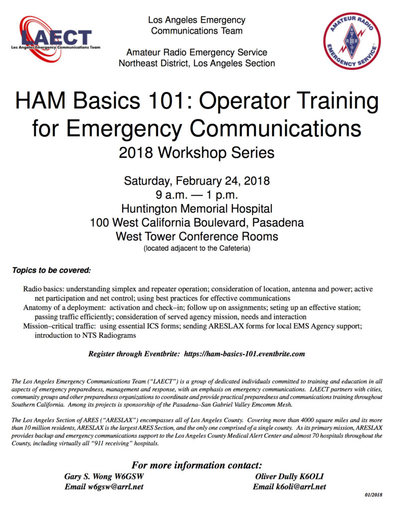
SPARC’s own Oliver Dully K6OLI will be leading a series of training sessions at our ARES Northeast activity days, held the last Saturday of the month at Huntington Hospital. The goal is to practice emergency communications skills. If you have never had proper training or you would like a better understanding of how to put your ham skills to use, visit the first session on February 24.  If you have any questions, feel free to contact Oliver or Gary Wong W6GSW at the email addresses on the flyer below.

Click here for Activity Day Training 2018 flyer as PDF.

The Raymond Fault: Now Even Bigger!

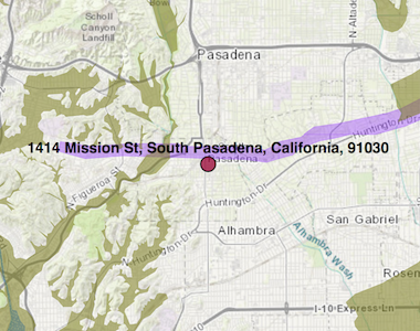
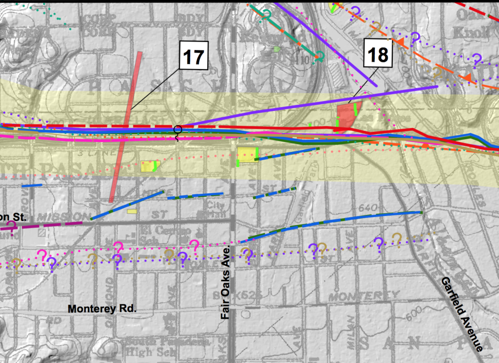
The LA Times reported today that  the California Geological Survey has issued a revised map of the Raymond fault which indicates the fault is longer than was previously believed. Experts now say that an earthquake along the Raymond fault, which runs directly under South Pasadena, could be as large as a magnitude 7. Uh oh.

California Geological Survey Map

Today’s article by Rong-Gong Lin mentions a specific risk factor in our city. “South Pasadena only recently decided to take a new look at brick buildings and found out that nearly half of the 60 brick structures — including stores, restaurants, apartments and churches — in that city were not retrofitted” to protect against earthquake damage.

If you want to learn more about the new map, check out the full press release on the California Geological Survey’s website. The Survey also provides a detailed map of faults throughout the entire state. And if you’ve been meaning to get more prepared for a possible quake, “Putting Down Roots in Earthquake Country” by the USGS is a great place to start.

Thanks to Oliver K6OLI and Tim WA0PTC for the info.